

9/7/09
I was up by 5:45 – quite a trick since I could not sleep last night. Yup, that happens, even in Alaska sometimes!
I ate breakfast at the Music of Denali Breakfast buffet which features mountaineer, Laurent Dick, each morning, visiting with guests, showing slides of his climb to the Mt. McKinley summit.
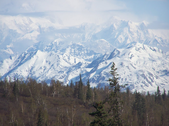
By 7:30, I was on my way again to the tour, “Glacier Landing by Plane”. I’ll attach pictures – but I’m typing offline. If I dare to type directly onto the blog and there is a glitch….and there are so many ….IF there is internet at all, then everything would disappear.
It seems there is so little time to write but I want not to lose these memories! In less than two weeks I’ll be home and my other world will overtake me again. The people who are renting a room in my house have decided to move on and my friend who is renting the little house across the street will be moving too. I always stress over who to get for renters and I know stress will quickly follow as I strain to cover all the bills and an extra mortgage working halftime again. I do work to remember that transitions actually require change to be real transitions. Ha, how profound.
I think I like change only when I instigate it.
Today I flew to Mt. McKinley with the same pilot as before, Bruce. He’s the dad of the chief pilot. We flew in a 1966 DeHaviland Beaver. Only 79 were manufactured with the turbo prop jet engine that this one has. They were designed for the Canadian government as military planes.
There are 5 native Alaskan tribes. The tribes around McKinley are referred to as Athabascans. They migrated with the seasons between Broadpass and the Healy area. The Healy area was their winter home because there is less precipitation (snow) in winter here. Broadpass was their summer home. It is magnificently beautiful. I was sorely tempted to stop and take photos a couple of weeks ago when I was on Hurricane Ridge duty.
In 1970 the Parks Highway was completed – named for George Parks. Before the completion of the highway Healy residents relied solely on the railroad for transportation. Of course, all visitors to the park also arrived by train. There was a road but there were no bridges so it went along in fits and starts, was a dirt road only and was rarely used.
Our plane flew at 9,500 feet over Princess Lodge. I got some pictures. If they come out, they’re all the red roofs. Princess is the largest resort lodge in Alaska with 656 rooms – spread out all over!
If you’re reading this (thanks! And) you’ll know I took notes during today’s flight. This pilot is so full of good information!
The Alaskan range is small by lower 48 standards – only 650 miles long and 40 miles wide. It has a huge impact on precipitation in Alaska, though. Rain and snow are measured in feet on the south side of the range and in inches on the north side.
Four flight companies are permitted to land on Mt. McKinley glaciers. They serve the climbers and the tourists. They were all operating before the current national park rules were instated and have been grandfathered in. Healy is 100 miles from Mt. McKinley. Our first photo opportunities were at 50 miles from Mt. McKinley. I’m not sure how far we were for the closeup views. That felt like measurement should be in feet or inches – but we were probably at least a mile away. Wish I’d thought to ask. The latitude of Mt. McKinley is 62 degrees.
The Alaskan range is a product of two tectonic plates, the North America plate and the Pacific plate, crashing up against each other. Mt. McKinley was produced by the Pacific plate being shoved upward. The black color of the rock is from the ocean bottom. The Athabascan religion centered on Mt. McKinley. The north peak was the mother. The south peak was father and two nearby peaks were son and daughter.
Within Denali, at Sanctuary, is the largest population of grizzlies in the world.
By the way, tonight as I type this, there have been several sightings of a very large grizzly at the kettle ponds up the road a couple of miles. He appears to be gorging on berries. A naturalist I listened to recently conjectured that bear and berries SOUND alike because their root words were the same. The bears eat tons of berries – and there are fields of berries up here simply called Bear berries. Kettle ponds, by the way, are created by the gouging of glaciers. Wonder Lake is a prime example of a huge kettle pond – 4 miles long, ½ mile wide and 280 meters DEEP.
There are now 400,000 visitors to Denali park each year.
We watched Muldrow Glacier as we ascended Mt. McKinley. Medial morane is the black gravel in the center – the glaciers push sediment from the sides to the middle of the flow. Terminal morane ----hmmm. I need to understand that better before I try to explain that – even and especially to myself.
Mt. McKinley is only 50,000 years old. From a satellite view, the Alaskan range resembles a human skeleton with Mt. McKinley being the skull. The rest of the range lies east of McKinley.
Most glaciers move 5-10 feet per year. Muldrow Glacier, however, is a “floating” glacier. In 1957 Muldrow Glacier moved 2-1/2 miles. The ice on Muldrow Glacier is 2,000 feet deep. The black color seen in the glacier is the terminal moraine which covers the ice. Even where I can see vegetation, the ice is directly underneath and 2,000 feet thick.
We tried to land on Eldridge glacier but were unable because of the heavy cloud cover today. On that glacier, the ice is only 500 feet deep and is covered in 45 feet of snow. The mountain directly left of McKinley as we fly is Mt. Mather. Hahahaha. But we flew clear around Mt. McKinley. So I don’t think that note was very helpful.
At Mt. McKinley, we flew at 11,300 feet. At 12,000 feet we’d have to use oxygen masks. (Later we flew just under 12,000 feet to manage the cloud cover and visibility)
We saw Wonder Lake and Burke Glacier to the north. The black mountains are on the south side of the range and the gray mountains are on the north. This is the continental divide of Alaska and the black rock is Pacific Ocean sedimentary rock. The gray is from …..(not easy taking notes while flying and taking pictures – sorry. I lost that info!)
In 1905 a federal judge was exiled to Alaska. He lived at Kantishna (the furthest point on the road in Denali Park and the original site of the gold found that created the Gold Rush)
Five times he tried to climb Mt. McKinley. He had terrific equipment and he had horses to pack. He didn’t realize that he was trying to climb a 14,000 foot vertical slope of ice. It is now known as Wickersham Wall and it is absolutely magnificent. On another flight, we flew from the bottom to the top of that wall and that’s as close as I ever hope to come to mountain climbing.
Our airspeed today was 110 knots.
With the cloud cover today we can see 75 miles at 12,000 feet.
I had planned to go into the park again today (on the ground, that is) but when I had the chance to try again to do a glacier landing, I just took it. We still didn’t get to land – but it was worth it. I have one more day off – on Friday. I’ll take a trip into the park one last time then. I am in the park much of the time, often even while I’m working but I mean into the PARK – I love the gravel road bus rides and the wildlife and vistas. I’m going to miss this place.
I was up by 5:45 – quite a trick since I could not sleep last night. Yup, that happens, even in Alaska sometimes!
I ate breakfast at the Music of Denali Breakfast buffet which features mountaineer, Laurent Dick, each morning, visiting with guests, showing slides of his climb to the Mt. McKinley summit.
By 7:30, I was on my way again to the tour, “Glacier Landing by Plane”. I’ll attach pictures – but I’m typing offline. If I dare to type directly onto the blog and there is a glitch….and there are so many ….IF there is internet at all, then everything would disappear.
It seems there is so little time to write but I want not to lose these memories! In less than two weeks I’ll be home and my other world will overtake me again. The people who are renting a room in my house have decided to move on and my friend who is renting the little house across the street will be moving too. I always stress over who to get for renters and I know stress will quickly follow as I strain to cover all the bills and an extra mortgage working halftime again. I do work to remember that transitions actually require change to be real transitions. Ha, how profound.
I think I like change only when I instigate it.
Today I flew to Mt. McKinley with the same pilot as before, Bruce. He’s the dad of the chief pilot. We flew in a 1966 DeHaviland Beaver. Only 79 were manufactured with the turbo prop jet engine that this one has. They were designed for the Canadian government as military planes.
There are 5 native Alaskan tribes. The tribes around McKinley are referred to as Athabascans. They migrated with the seasons between Broadpass and the Healy area. The Healy area was their winter home because there is less precipitation (snow) in winter here. Broadpass was their summer home. It is magnificently beautiful. I was sorely tempted to stop and take photos a couple of weeks ago when I was on Hurricane Ridge duty.
In 1970 the Parks Highway was completed – named for George Parks. Before the completion of the highway Healy residents relied solely on the railroad for transportation. Of course, all visitors to the park also arrived by train. There was a road but there were no bridges so it went along in fits and starts, was a dirt road only and was rarely used.
Our plane flew at 9,500 feet over Princess Lodge. I got some pictures. If they come out, they’re all the red roofs. Princess is the largest resort lodge in Alaska with 656 rooms – spread out all over!
If you’re reading this (thanks! And) you’ll know I took notes during today’s flight. This pilot is so full of good information!
The Alaskan range is small by lower 48 standards – only 650 miles long and 40 miles wide. It has a huge impact on precipitation in Alaska, though. Rain and snow are measured in feet on the south side of the range and in inches on the north side.
Four flight companies are permitted to land on Mt. McKinley glaciers. They serve the climbers and the tourists. They were all operating before the current national park rules were instated and have been grandfathered in. Healy is 100 miles from Mt. McKinley. Our first photo opportunities were at 50 miles from Mt. McKinley. I’m not sure how far we were for the closeup views. That felt like measurement should be in feet or inches – but we were probably at least a mile away. Wish I’d thought to ask. The latitude of Mt. McKinley is 62 degrees.
The Alaskan range is a product of two tectonic plates, the North America plate and the Pacific plate, crashing up against each other. Mt. McKinley was produced by the Pacific plate being shoved upward. The black color of the rock is from the ocean bottom. The Athabascan religion centered on Mt. McKinley. The north peak was the mother. The south peak was father and two nearby peaks were son and daughter.
Within Denali, at Sanctuary, is the largest population of grizzlies in the world.
By the way, tonight as I type this, there have been several sightings of a very large grizzly at the kettle ponds up the road a couple of miles. He appears to be gorging on berries. A naturalist I listened to recently conjectured that bear and berries SOUND alike because their root words were the same. The bears eat tons of berries – and there are fields of berries up here simply called Bear berries. Kettle ponds, by the way, are created by the gouging of glaciers. Wonder Lake is a prime example of a huge kettle pond – 4 miles long, ½ mile wide and 280 meters DEEP.
There are now 400,000 visitors to Denali park each year.
We watched Muldrow Glacier as we ascended Mt. McKinley. Medial morane is the black gravel in the center – the glaciers push sediment from the sides to the middle of the flow. Terminal morane ----hmmm. I need to understand that better before I try to explain that – even and especially to myself.
Mt. McKinley is only 50,000 years old. From a satellite view, the Alaskan range resembles a human skeleton with Mt. McKinley being the skull. The rest of the range lies east of McKinley.
Most glaciers move 5-10 feet per year. Muldrow Glacier, however, is a “floating” glacier. In 1957 Muldrow Glacier moved 2-1/2 miles. The ice on Muldrow Glacier is 2,000 feet deep. The black color seen in the glacier is the terminal moraine which covers the ice. Even where I can see vegetation, the ice is directly underneath and 2,000 feet thick.
We tried to land on Eldridge glacier but were unable because of the heavy cloud cover today. On that glacier, the ice is only 500 feet deep and is covered in 45 feet of snow. The mountain directly left of McKinley as we fly is Mt. Mather. Hahahaha. But we flew clear around Mt. McKinley. So I don’t think that note was very helpful.
At Mt. McKinley, we flew at 11,300 feet. At 12,000 feet we’d have to use oxygen masks. (Later we flew just under 12,000 feet to manage the cloud cover and visibility)
We saw Wonder Lake and Burke Glacier to the north. The black mountains are on the south side of the range and the gray mountains are on the north. This is the continental divide of Alaska and the black rock is Pacific Ocean sedimentary rock. The gray is from …..(not easy taking notes while flying and taking pictures – sorry. I lost that info!)
In 1905 a federal judge was exiled to Alaska. He lived at Kantishna (the furthest point on the road in Denali Park and the original site of the gold found that created the Gold Rush)
Five times he tried to climb Mt. McKinley. He had terrific equipment and he had horses to pack. He didn’t realize that he was trying to climb a 14,000 foot vertical slope of ice. It is now known as Wickersham Wall and it is absolutely magnificent. On another flight, we flew from the bottom to the top of that wall and that’s as close as I ever hope to come to mountain climbing.
Our airspeed today was 110 knots.
With the cloud cover today we can see 75 miles at 12,000 feet.
I had planned to go into the park again today (on the ground, that is) but when I had the chance to try again to do a glacier landing, I just took it. We still didn’t get to land – but it was worth it. I have one more day off – on Friday. I’ll take a trip into the park one last time then. I am in the park much of the time, often even while I’m working but I mean into the PARK – I love the gravel road bus rides and the wildlife and vistas. I’m going to miss this place.
No comments:
Post a Comment